WP4: integration and experimentation

The WP4 will have to design and experiment the integrated forecasting chains (hydro-meteorological, inundation and impacts) on several case studies, and to gather feedback from end-users. It will involve all project contributors, from scientific teams to the different end-users, offering opportunities for a rewarding dialogue at different steps of the project. The work package is organized in 4 main tasks.


A first step aimed at identifying the needs of end-users at the beginning of the project. It took the form of a common workshop involving all project contributors and the end-users group, organized in Lyon the 17th of May 2018. The workshop aimed to identify the end-user expectations, but also to reformulate these needs according the current “state of the art” (what will be feasible or not), to finally help the project teams to define where to assign their efforts. Finally, this workshop was also dedicated to the identification of relevant case studies for an illustration of the capacity of integrated forecasting chains to fulfil the needs.


A second task aims at defining the structure of the integrated forecasting chains to be tested and the associated validation strategies. The objective is here to define how the contributions from the different WPs (hydro-meteorological nowcasting, inundation and impacts) will be chained to meet the different end users expectations. A particular attention will be put here on the consistency across the various components of each chain regarding: the variables used, level of resolution, application scale, and degree of uncertainty. This task will also have to address the crucial question of the methodology to be used for results validation, depending on the selected case studies, the characteristics of the forecasting chains to be tested, and the available observation datasets (damages, etc.). Methodological aspects (testing schemes, criteria) related to the evaluation of probabilistic forecasts in space and time will also be addressed.


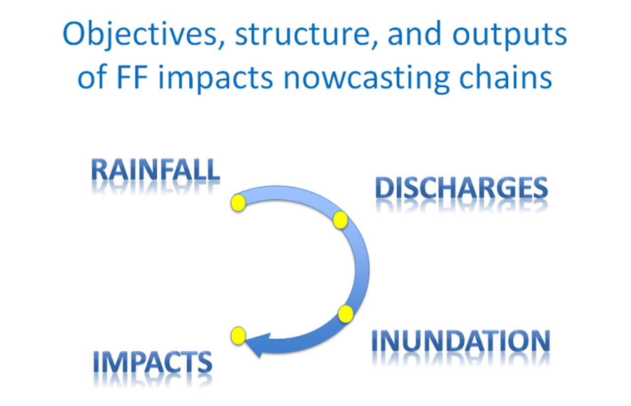
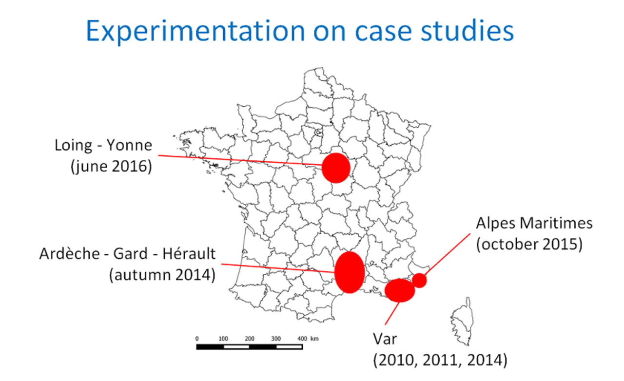
Another task includes the definition and documentation of the most interesting events to be used for the evaluation. The SCHAPI, which is running the national ‘Vigicrues-Flash’ warning service, will help to identify relevant events, based on the feedbacks received from local actors. A strong effort will be put on the collection of data enabling to assess the performances of all components of the forecasting chains: peak discharges (obtained if necessary from post event surveys), extent of observed flooded areas, and also all kind of useful information for the characterization of impacts (submersion of roads, habitations, etc) and of their timing. This last information will be collected through public data, such as social network or medias, and also based on the contribution of end users group and local authorities. This information will be complemented if necessary by field surveys.

The last task aims at implementing, running, and evaluating the integrated forecasting chains for the selected events and case studies. The warnings of the ‘Vigicrues-Flash’ system will be used as benchmarks for the evaluation. The main questions addressed here will be the following: which accuracy of the forecasts? which critical components in terms of uncertainty? which capacity to fulfil the end user’s needs? These questions will be addressed based on common workshops involving the project partners and end users group.