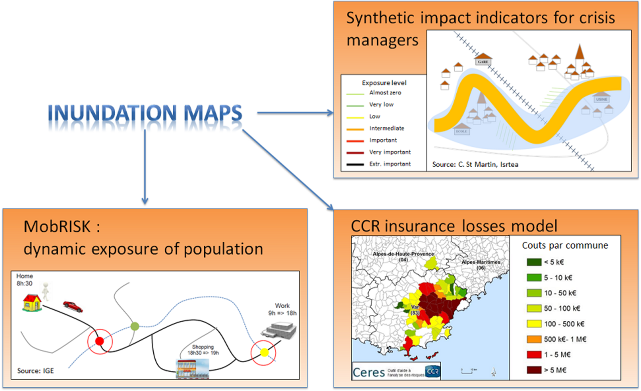
The third work package intends to improve different socio-economic impacts modelling approaches, with a common objective of integrating new knowledge on flood areas, water heights, and flow velocities provided by WP2 outputs. This work package includes three main tasks related to three different natures of impacts, which are detailed hereafter.
The first part aims at modelling of population’s dynamic exposure and vulnerability. This task will involve the MobRisk model of population exposure in situation of mobility (IGE), and also the RIWS model of transport infrastructure inundation risks (Ifsttar). The main objective will be to improve and combine these methods based on the new input information on flood areas (WP2). Another objective will be to simplify these approaches to facilitate their large scale applicability.
The second part deals with the development of synthetic impacts indicators to facilitate emergency management decision-making. The approach applied here was developed in the PhD of Clotilde Saint Martin (Irstea Aix). It will be adapted here to the selected case studies based on the detailed information on flood areas provided by WP2. The main question here will be to measure the added value of detailed information on flood areas, to better represent the intensity of impacts and their temporal dynamics.
The last part includes the modelling of insurance losses. It aims to adapt the CCR insurance losses model to take advantage of the enhanced hazard information provided by WP2. This is equivalent to replace the hazard part of the CCR model, to evaluate if this enhanced hazard information can improve the final modelling results.


