The second work package of the PICS project deals with the estimation of flood areas. It aims at improving and evaluating hydraulic computation methods, easily applicable on the large number of river reaches potentially affected by flash floods.
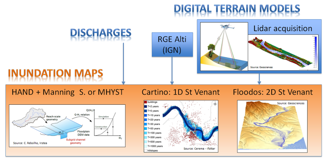
A first task includes the acquisition and processing of Lidar data. The use of a state of the art topo-bathymetric airborne Lidar, operated by Géosciences Rennes, will enable to characterize at very high resolution the topo-bathymetry of rivers in two different areas of the selected case studies. New Lidar processing methods will be developed to take benefit from the potential of this data, for instance for the estimation of hydraulic roughness.
A second task includes the application of “automatic” DTM-based hydraulic approaches for flood areas modeling. Three different methods will be investigated in the project: i) an approach based on the estimation of height-discharge curves at the river reach scale (HAND-MHYST), ii) the Cartino approach (Cerema, Ifsttar) enabling to apply automatically steady-state 1D hydraulic computations; and iii) the 2D Floodos hydrodynamic model developed by Géosciences Rennes. The main objective will be to evaluate the adequacy between the complexity of the methods, their accuracy, and the time and space scales of the intended applications. The propagation of uncertainties related to topographic data - quality and resolution - and roughness will be evaluated, with particular attention paid to the representation of the hydraulic geometry of the studied watercourses. The complementarity between the three modelling approaches will be studied in order to propose a continuous modelling of flood areas covering the whole hydrographic network in the context of flash floods forecasting.